Goodbye to all that

Gallery

This gallery contains 13 photos.

Kim Devereux-West – Land of Iron Cultural Heritage Assistant It’s that time already; my two year contract with the Land of Iron is almost over! With only a few days left on the clock I wanted to take a moment to … Continue reading

Making Pictures

Nicola White – Land of Iron Film Maker Intern

I’ve spent the past 12 weeks clambering over the North York Moors with my camera, capturing the elements that form the Land of Iron Landscape Partnership Scheme. This adventure has been challenging, hilarious and hot (given the summer we’ve had).

I began with the Combs Wood excavation, bugging the volunteers each morning by crouching on the ground to get the best shot as they dodged their wheelbarrows around me. It was incredible to see them constantly uncovering something new and seeing just how much had been hidden by the nature that surrounded us. See Combs Wood Part 1 – Volunteering, Combs Wood Part 2, and Combs Wood Part 3.

I also got involved with the Warren Moor Mine conservation work this summer. The details of the huge chimney still on site really are incredible. My video focuses on the lime mortar work that the team have completed on the engine beds, as well as all the previous clearing that has taken place during the project in order to preserve the features. It’s impressive to view the impact that Land of Iron has had on this area, and for that reason it’s recorded in my video. See Warren Moor – The Movie

I didn’t just concentrate on the impressive industrial building sights; I’ve also created a video showing the environmental conservation work undergone. From fences and walk ways at Fen Bog to forest work and tree planting across Rosedale, my video illustrates how this work is restoring habitats and encouraging rare species. See what I saw

The final video of my creation sets out to capture the entire essence of the Land of Iron. Focusing on the three main aspects – history, people, environment – this video uses interviews with the core team and footage that I’ve recorded throughout my summer with them, to explain what the programme is all about. See the whole picture …

This summer has been an incredible opportunity to learn and create. The people surrounding and supporting the Land of Iron scheme should receive a medal for all the work they do; constantly typing away on their keyboards in the office or covered in mud down a one-meter deep hole. It’s been a pleasure to dig in the mud with them for such a short time, and I hope I spend all my future summers in a similar way.

Something else … The Land of Iron Landscape Partnership Scheme is approaching its halfway point with building conservation works starting on site and teams of volunteers across the North York Moors helping us care for our fascinating industrial heritage. We’re currently undertaking an EVALUATION SURVEY – this is a really important way to check the scheme is heading in the right direction and achieving what it wants to. Please give us a few minutes of your time to tell us what you think. Your feedback will help shape the next stage of the programme. 

Combs Wood – Another Community Excavation

Eleanor Lees – Land of Iron Community Archaeology Intern

After a very wet dig back in May 2017, Land of Iron volunteers and staff returned for a second season of excavation at Combs Wood, Beck Hole in July 2018 to investigate this important iron working and mining site. Luckily for us the weather held – we got to experience excavating in the hottest summer since 1976!

One of the major elements of the Land of Iron Landscape Partnership Scheme is investigating the ironstone industry from the early 19th century to the early 20th century in the North York Moors. Like many of the remains from the iron industry in the area since that time, Combs Wood has been reclaimed by the natural environment. With only 10 days to excavate we had a lot of questions to try and answer…

Land of Iron - Combs Wood excavation July 2018. Copyright NYMNPA.

A Brief History of the site

Combs Wood is part of the Goathland Forest complex which belongs to the Forestry Commission. The site itself lies near the base of Goathland Incline and undoubtedly linked up with this railway line. The incline itself is so steep that in order to get the loaded coaches and wagons up to the top a gravity system was used – water butts were placed at the top of the incline and their weight was used to offset the weight of the wagons. Once the water butts were at the base of the incline they could be emptied and brought up to the top by horses. The horse-powered railway was converted into a steam hauled railway in 1845, and at some point the incline itself was transformed to steam power with a stationary engine at the top. The incline was eventually abandoned in 1865 (after an accident killed two and injured 13) in favour of a more level route, known commonly at the deviation line.

In 1857 that Whitby Iron Company was formed and began to construct the ironworks in Combs Wood. A series of drift mines were opened connected by elevated sets of tramways. The first iron was cast in 1860 and is commemorated by a cast-iron tablet in Whitby Museum. However the following iron working and mining operations were nothing short of disastrous until eventually in 1861 the owners offered the whole plant for sale. Receiving no bids the operation struggled on until a stormy night in 1864 when a landslide buried the two main access drifts, and demolished the beckside tramway and the water leat to the water wheel. No lives were lost but operations never resumed.

Nearby the small Beck Hole hamlet had changed exponentially with the opening of both the railway and the iron works. A row of 33 workers cottages were built corresponding with the workforce and their families. Birch Hall Inn was extended to include a provisions store. In 1860 the inn was licenced to sell ‘Ale, Porter, Cider and Perry’, vital for any workforce. The population boom ended in 1864 with the mines closed and the furnaces dismantled, the cottages were demolished and the only reminder in Beck Hole of a once lively iron industry was the expanded Inn. The ironworks site and associated cottages and infrastructure began to slowly recede under the encroaching vegetation…

Combs Wood excavation July 2018. Copyright NYMNPA.

The Excavation

Entering the site, we passed the remains of the bridge that once connected the ironworks to the other side of the Murk Esk river and the Whitby to Pickering railway line. At first, the lower part of the site appears to be fairly straight forward. To the right, there is a stone building potentially an office for a manager or clerk. It has two floors with evidence to suggest that the walls may have even been plastered. To the left, there is a wheel pit for a wheel powered by the river that runs perpendicular. We cleaned and recorded the office building as most of the necessary excavation here had already been completed during the previous season.

The wheel pit was another story and there was nothing simple about excavating this feature. which involved navigating the metal poles (cross acro clamps) used to shore up the pit walls, and the daily water removal from the pit bottom. The aim of excavating the wheel pit was to reveal and record the floor of the structure and to gain a greater understanding of its purpose and extent. However, as the excavation progressed, more and more questions about this feature emerged. While we now have a good idea of how the timber water wheel would have worked; we have less idea about what it actually powered. An investigation into a structure on the next level of the site was made to try and see how the wheel pit may have related to other structures on site, including a channel which ran from one level to the next.

Continuing along the tramway we made our way further up into the woods to the upper part of the site which holds arguably more mysteries to uncover. A row of collapsed buildings emerge from the grass to the left and ahead an unidentified structure which was almost completely hidden by vegetation. The first building we chose to explore is the middle of the three larger buildings. It revealed a red earth floor with slag (a waste product of iron working) scattered throughout. The main feature of the room is the ‘forge’ which is still in surprisingly good condition. Theories behind the purpose of this feature on the site are various, ranging from testing the quality of the iron ore coming out of the mines, to creating the horse shoes for the mine horses. To the left of the forge, we discovered an incredibly intact stable floor. The floor shows a drain running along the length of the stable with drilled post holes used to create the wooden stalls for the individual horses.

Have a look here to see a fab 3-D image of both the forge and the stable

Starting Them Young

On the first Saturday of each month the National Park Authority run the Moors and Valleys Young Archaeologist Club (YAC) for young people aged 8 to 16 years. For the July session, the club joined us on site at Combs Wood to experience a working archaeological excavation. The children were treated to an in-depth tour of the site and also got to sieve through the spoil heap to find any artefacts that the volunteers and staff had missed. The club did very well, discovering tile, pottery and even a nail.

YAC at Combs Wood excavation July 2018. Copyright NYMNPA.

Our Amazing Volunteers

The amount that we achieved in just 10 days is astounding and a credit to the work ethic of our volunteers. Not only did they shift tonnes of soil and stone they assisted with the public tours, and provided knowledge and insights which helped establish a greater understanding of the site. Without them the excavation would just not have been possible.

Thanks also to the Forestry Commission for permission to keep excavating.


Land of Iron Landscape Partnership Scheme logos

Goathland Incline: a Community Archaeology Dig

Maria-Elena Calderón – This Exploited Land of Iron Cultural Heritage Officer and David Mennear – This Exploited Land of Iron Administration Assistant

Introduction 

This Exploited Land of Iron, our HLF Landscape Partnership Scheme, has had a busy and successful first summer with well attended events and exciting activities taking place across the North York Moors. This Exploited Land of Iron is investigating the once booming ironstone industry, which spread across the area from the early 19th century until the mid-20th century, although you may not easily notice its intrusion on the beautiful landscape today.

Following our first archaeological dig at Combs Wood (Beck Hole) back in May, our second archaeological excavation recently took place at the Goathland Incline over a two week period between 25 July and 5 August. It proved particularly popular with volunteers and passing visitors.

Today the village of Goathland is a peaceful and idyllic haven for tourists, a former spa town famous for the North Yorkshire Moors Railway and for masquerading as the fictional village of ‘Aidensfield’ from the old TV series, Heartbeat. You wouldn’t know today to look around the village, but Goathland once played a brief but fundamental part in the 19th century ironstone mining industry, a noisy and disfiguring industry that required the transport of thousands of tonnes of ironstone across the North York Moors via railways. In fact not many historic photographs of the Goathland Incline survive at all. As such we didn’t quite know what existed or what remained. Targeted archaeological excavation, following a thorough study of the area and its history beforehand, was undertaken to investigate the remains at the Incline..

Goathland Incline: A Brief History of a Modern Mystery

The site itself dates to a brief period in the mid-19th century when the railway was in its infancy. The early Whitby to Pickering horse-drawn railway was designed in the 1830s by none other than George Stephenson, the famous and much in-demand ‘Father of the Railways’. For the majority of the line, wagons and carriages were hauled using horse power; however, due to the 1 in 5 gradient present between Beck Hole and Goathland, an alternative power source was required. Powered inclines had been in use for a number of years by this point, employed primarily at mines. At Goathland a gravity system was used to haul the wagons and carriages up the incline – water butts were filled at the top of the incline and their weight was used to offset the weight of the wagons themselves, effectively and somewhat spectacularly pulling them up the incline. Once the water butts were at the base of the incline, they could then be emptied and brought back up by horses to be used again.

In 1845 the horse-drawn railway was transformed into a steam hauled railway by the new owner, a certain Mr George Hudson. At some point the incline itself was also transformed to steam power with a stationary engine sitting at the top of the incline. The engine house is shown on the Ordnance Survey map surveyed in 1849, but we’re currently unsure of the exact year that this new feature was installed. The conversion to steam power also required the installation of turntables at both the top and foot of the incline itself, as unlike the horses, locomotives could not turn themselves around in such a small space.

The incline was a perilous operation and was known to fail; a crash in 1864 killed 2 people and injured 13. In 1865 a deviation line was built which took a wider route with a shallower gradient that eliminated the need for an incline. The buildings were demolished, the site was abandoned to be subsumed back into Goathland village and the rest, as they say, is history.

The Dig Itself

Due to the early date of the railway at Goathland a lot of the layout relating to the gravity system remains unknown as it was replaced before the earliest ordnance survey maps. So we decided to open a series of trenches that targeted known historical structures and possible new structures identified by a LiDAR survey. Using remote sensing LiDAR maps the topography of the land from above and because it takes measurements from a variety of angles, it can effectively see though heavy vegetation and wooded areas. This allows for the identification of possible building structures or man-made earthworks within the targeted area.

LiDAR image of Goathland Incline Site. Copyright NYMNPA.

Light Detection and Ranging, otherwise known as LiDAR, is a remote sensing method used in archaeology to examine the landscape surface. Here you can see the representation of the land around the historic site of the Goathland Incline, including a suspected turntable.The purple circle is the turntable and the blue rectangles the main trenches targeted within the red study areas

We placed three trenches over a circular feature suspected to be a turntable, one over a series of linear features shown in LiDAR and thought to be the remains of buildings, and one over the alleged engine house for the stationary engine.

The engine house location proved true but unfortunately not the rest. In archaeology, with both the best will and research in the world, you never truly know what you are going to uncover. The turntable was in fact a reservoir and what looked like building remains were probably instead the remains of allotment beds.

Goathland Incline Excavation July/August 2017. Copyright NYMNPA.

Our amazing volunteers hard at work on the trench that provided to be a bit of a damp squib.

The reservoir was interesting in itself as it turned out to be a clay capped earthen structure that had silted up over the years and had obviously been used as a rubbish dump. Finds such as jars, broken toys, Victorian glass bottles and ceramic wares gave us an insight into 1860-1940s Goathland life. Despite the late nature of the finds themselves, the structure itself we believe dates from the early gravity system, and offers us the only archaeological insight into that period. At that geographic level in Goathland there is no fast flowing water supply sufficient enough to fill the water butts for the gravity-assisted incline system. As such large water storage areas would have been required and allowed to fill on a slow trickle. Could this be what the reservoir was used for?

Goathland Incline Excavation July/August 2017. Copyright NYMNPA.

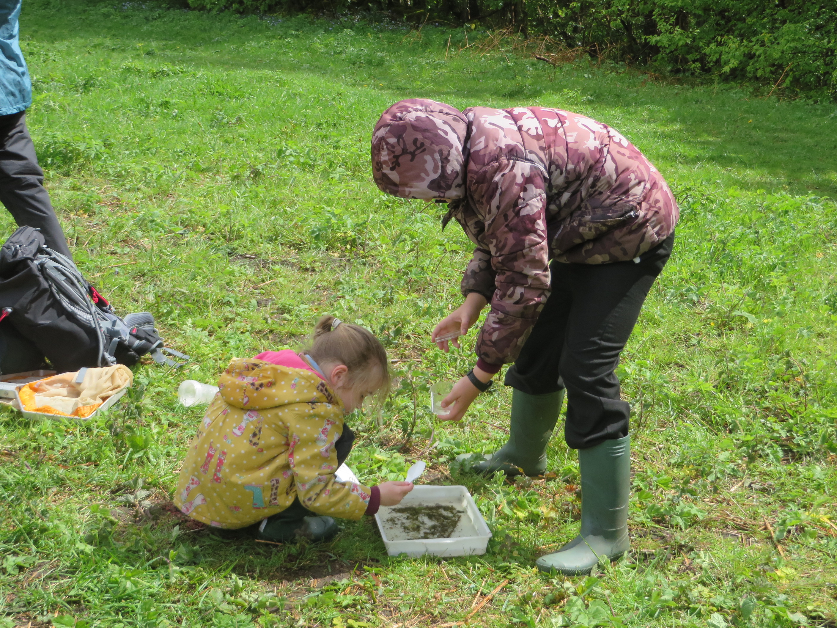
Getting down and dirty investigating one of the trenches with our Cultural Heritage Officer Maria Calderón and placement student Ewan Chipping to see what great work the volunteers have done.

Within the trench targeting the engine house we found substantial remains of stone walls 70-80cm (28-32”) thick with foundations continuing below a 1.4m (4’ 8”) depth from the surface level. It is clear that the engine house was a substantial structure with a basement. There were two internal rooms divided by a further stone wall. The building would have been roofed in slate, rather than the local vernacular of pantile; this is typical of railway buildings, as the companies that operated the railways worked on a regional or national level, and did not respect local building traditions.  Sadly we found no evidence of conduits or the stationary engine. In all likelihood most of the metal worked was instead probably sold for scrap at some point. To the north of the building we found traces of a stone covered yard.

Goathland Incline Excavation July/August 2017. Copyright NYMNPA.

‘Have you found anything interesting?’ We certainly did! You can tell by the foundations of the stone walls in this trench that a substantial building once stood here, like the engine house.

Goathland Uncovered: Mystery Solved?

But we had not given up on the turntable and with the help of a local resident we gained permission to open further excavations on the site. We opened six small test pits and hit the remains of a turntable in three pieces; two edges and at the centre point, from which we can extrapolate the size. This was a highlight of the excavation and was the fruitful work of a few very determined volunteers. One of the smaller test pits also identified the corner of a brick building that had been demolished.

A successful dig then, but questions still remain regarding the Goathland incline site:

a) How deep does the engine house go?
b) Are there any remains in the rooms waiting to be discovered?
c) Where was the cable drum for the incline?
d) What is the small brick building?

With these questions lingering in our minds after the excavation we’ll now process the information recorded and help to produce archaeological reports based on the available evidence. As always with archaeological fieldwork there may be more questions than answers, but what this dig helped uncover is invaluable to learning about the industrial life of the Goathland Incline and the individuals who worked on it and lived nearby.

Goathland Incline Excavation July/August 2017. Copyright NYMNPA.

Last but not least, we also had time to celebrate Yorkshire Day on the 1st August with a good mug of Yorkshire Tea!

In amongst the digging we also managed to make a short film (in very windy conditions) – have a look here.

We would like to extend a big thank you to all of our volunteers who took part in the excavation, and also a big thank you to all of the members of the local community who came to visit us and asked great questions or provided invaluable insights into Goathland life and industry.

To learn more about upcoming events and volunteering opportunities, please contact the Land of Iron team on 01439 772700 or email us.

What on earth is going on?

Gallery

This gallery contains 55 photos.

This Exploited Land of Iron is our HLF Landscape Partnership Scheme focused on the ‘blazing, booming, enterprising’* ironstone industry in and around the North York Moors in the 19th century, and its surviving legacy. The Scheme was officially launched in … Continue reading

This Exploited Land – a poetic mix of Victorian beauty and brass

Tom Mutton – TEL Programme Manager

When businessmen visited the Beck Hole Ironworks in 1860 their report in the Whitby Gazette gave a beautifully poetic account of this new enterprise. Despite the author’s lyrical writing style the article also illustrates a perceived total domination over the natural world that was the foundation of the industrial revolution.

This is partly what This Exploited Land is all about. Although in modern times we may miss the elegant language of the Victorian era, many of us have a very different view of the natural world and the potentially devastating effects of humanity’s exploitation of the planet. The way that nature has reclaimed the mines of the Esk Valley and Rosedale is humbling to see and shows us that we are surrounded by a beautiful and fascinating world that we should use our intellect to care for rather than abuse. To do this best we need to remember and learn from the past, being inspired by the monumental relics in the landscape and the stories from our ancestors who lived very different lives in the North York Moors we now enjoy.

Transcribed from Whitby Gazette 16 June 1860:

“…It is our pleasing duty to report the successful operation of the Whitby Iron Company’s (Limited) Works, at Goathland, which we noticed in our last impression as having been blown in on 7th inst.

A few of our principal townsmen spent Monday evening at those Works, and were delighted with the various departments. The magnificent engine which supplies the blast for smelting the iron from the ore moves round like a thing of life, and at once the ever-lasting hills of the valley resound with the voice as of a tide bursting upon our shores.

We heartily wish the Company success, as the pioneers in a pursuit which is destined to revolutionise the habits and maxims of the valley of the Esk, and with the facility of the rails and our own good port, we venture, the day is not distant when capital and enterprise will demand that the whole of the district become one grand scene of industry, and that, from one end of the valley to the other, Old King Coal, supported by the genius of man, will assert his power in developing those vast storehouses of wealth which, during the last few years, have attracted the attention of strangers to those exhaustless beds of minerals which nature has provided and stored up in this locality, for the use of man in the arts of civilised life. And Whitby will one day have to rejoice in the fact, that she is one of the principal ports in the kingdom for the export of iron to the commercial ports of the world.

Beckhole, the little village at the head of the valley where these works are situate, has now a strange sight to look out upon morning and evening, which are ushered in with a torrent of molten iron and a flood of lava gushing forth from the bowels of the company’s furnace. The sweet songsters of the woods and glens are now giving up their claim to the morning’s dawn and evening calm. The _________ voices of the sons of toil mingling with the music of the compressed air of the blast engine, wait for the dawn of the East, whilst the perpetual columns of vapour, smoke, and flame, tell of the presence of man, successfully reducing to practice the maxim of the company’s tablet, viz “Tis the prerogative of man to command, develope, and appropriate to his service the elements with which God has surrounded him.” The tablet at the foot of which the above inscription is fixed commemorates the incorporation of the Company, the date at which the first Iron was made upon the Works, and the names of the Directors; and was cast from the Iron first run from the furnace.

In this noble course of action the W.I.C.L., have led the way. We heartily wish them god speed, and doubt not the success which awaits their spirited enterprise; and hail with joy the event as a blessing to the surrounding neighbourhood, and the watchword to the progressive establishment if similar works, whose effect will be to convert this district into one of the most thriving seats of the iron trade of this country, creating labour for man and beast, and scattering in its train the blessings of trade hitherto unknown in the locality.”

WICL commemorative tablet - thanks to the Whitby Museum.

This tablet, referred to in the article and cast from the first Esk Valley iron, can be seen today in Whitby Museum.

It’s worth noting that Whitby Iron Company Limited was short lived – it was wound up in 1862.

Can you help?
There are two words in the article that are obscured by a tear in the paper from which it was transcribed – can you suggest what the missing words before ‘voices of the sons of toil…’ might be? please let us know.

Extract from the Whitby Gazette 16 June 1860 - thanks to Tammy Naylor.

This Exploited Land: the trailblazing story of ironstone and railways in the
North York Moors

tel-logo-band-1_final_crop-to-edge-inc-drf-logo

From Beck Hole to Brazil

Louise Cooke – This Exploited Land Progamme Manager

This Exploited Land has a wealth of stories to tell. These stories from the past can be traced on the landscape today and have tracks stretching out beyond the North York Moors.

For 30 years from 1836 the trains along the new Whitby to Pickering railway had to overcome the 1:15 incline at Beck Hole. The carriages were initially horse-drawn but when the trains came up against the steep gradient of the incline between Beck Hole and Goathland the only way up and down was pulling and holding the carriages on a system of wire ropes. Steam power took over from horses in 1845, but trains still had to negotiate the incline by means of winches. Winches are intrinsically dangerous; a fatal accident occurred in 1864. The delays, problems and dangers of using the incline motivated the construction of a more practical deviation line in 1865. This allowed steam locomotives to travel along the complete line for the first time, and this is the current route of the North York Moors Railway.

2015 LiDAR image - NYMNPA


Above is a detail of the TEL Lidar survey undertaken in the development phase of the TEL Scheme. The defined line at the top shows the route of the current NYMR Whitby-Pickering Railway. The less defined line through the centre shows the route of the Beck Hole Incline.

So what happened to the ‘abandoned’ Beck Hole incline which connects the TEL landscape to Brazil and to innovations in railway technology that changed the ways railways worked through the 20th century…

In 1872 a 685 metre length of 3’7” (narrow) gauge track was laid on the disused Beck Hole Incline and successful tests were carried on a fell-system locomotive built by Manning & Wardle of Leeds. A fell-system uses a third rail to provide the necessary extra power and control when travelling up and down intense slopes. Manning & Wardle narrow gauges were exported around the world to Europe, Africa, the Indian sub-continent, Australasia and South America – so this short stretch of the Beck Hole Incline may have had an impact on the wider world opening up mountainous regions to exploitation.

Four fell-system locomotives were purchased from Manning & Wardle for use on the Cantagallo Railway in Brazil. This was Brazil’s first mountain railway linking Niterói to Nova Friburgo and allowed coffee to be shipped down from the mountains and out to the coast for export.

Back in the North York Moors, late in 1908 the railway line from Grosmont to the foot of the incline was re-opened for an Autocar service which ran in the summer months until the outbreak of the war in 1914. The North East Railway’s Autocars used early experimental petrol engines that generated electricity, and so are predecessors of the diesel and electric trains which took over the railways through the 20th century. The excursion/day trips by Autocar to Beck Hole saw tourists and visitors making use of industrial remains within the declining industrial landscape at the time.

Part of the Beck Hole Incline today – now the Historic Rail Trail. Copyright NYMNPA.

The site of the former railway station at Beck Hole at the base of the Incline – shown by the stone edge. Copyright NYMNPA. The Beck Hole Incline is now the route of the Historic Rail Trail footpath between Goathland and Grosmont. Walking down the incline today it is hard to imagine how it worked and what it looked like in its hey-day. It is perhaps even harder to imagine how this now tranquil part of the North York Moors is associated with changes in railway technology and how Beck Hole can be connected to Brazil.

logoHLFNL_2747NYMNP-logo_92-pixel

1865

Stephen Croft – TEL Programme Manager

2015 sees a number of notable 150th anniversaries in the story of ironstone and railways in the North York Moors. It turns out that 1865 was an important juncture in industrial development in this area when elements combined to boost the output and feed expansion.

1865 saw the opening of the ‘deviation’ line on the Whitby and Pickering Railway which eliminated the need for the mechanical incline at Beck Hole using winches, allowing the railway to become fully steam hauled. This 1865 re-route around Beck Hole and Goathland remains the line of the North Yorkshire Moors Railway today, one of the oldest railways in the world still running on (most of) its original route. It was at this time that today’s Goathland Station was built beside the water mill – it was originally called Goathland Mill station.

Railway bridge feature - end of a tie rod - NYMNPA

1865 witnessed the completion of the North Eastern Railway (NER) North Yorkshire and Cleveland branch which connected Grosmont with Middlesbrough and hence linked the Whitby and Pickering line into the growing rail network and connected product with market. This, too, is still running today – as the Esk Valley line.

Railway bridge - NYMNPA

1865 saw the opening of the extension which took the railway line around the head of Rosedale to reach the mines and calcining kilns (heating ironstone to extract the iron) on the east side of the valley. The original railway had opened 5 years earlier but this extension meant that both sides of the dale were connected and exploitation augmented. The Rosedale Railway was operational until after mining ceased in the dale in 1926 and for three years afterwards the valuable mineral rich waste from the calcining process was recovered from spoil heaps. The tracks were then lifted but the Rosedale Railway route remains open today for walkers, cyclists and horse riders to experience.

Railway bridge underside - NYMNPA

1865 is when the rail network built across the North York Moors which serviced the ironstone industry, was complete. Whether still running as a railway today or now dismantled, these railways shaped the landscape we know and brought transformation to what had previously been a remote and isolated rural area. The railways enabled easier and quicker movement – not only providing a relatively cheap method of transport for the heavy ironstone, but also making goods manufactured in the towns available to the local rural community and vice versa, stimulating the market. They also provided a passenger service – the world’s first cut price railway excursion ran from Grosmont as early as 1839.

Railway lines - NYMNPAUntil the arrival of these railways, heavy goods such as building stone were laboriously exported via packhorse or cart along poor roads down into Whitby on the North Sea coast from where it was loaded onto ships. The railways revolutionised the viability of quarries allowing high quality stone to be sent down the coast to London and beyond where it was particularly valued for its resistance to seawater for the construction of harbour works and river embankments. It was to export this stone that the Whitby and Pickering Railway was first built and it was during its construction that ironstone was discovered in substantial seams at Grosmont. That discovery changed the history of the North York Moors.

So for 150 years, it has been possible to travel across the North York Moors by rail. The abundance of ironstone found here in the mid-nineteenth century and the railways to carry it away cheaply led on to the development of industrial Teesside, a world centre for iron and steel and heavy engineering – Gladstone’s ‘Infant Hercules’ – steaming forward beyond the second industrial revolution into a new idealised industrial age.

http://commons.wikimedia.org/wiki/ - File:North_Eastern_Railway_map_(centre).jpg

This Exploited Land (TEL) is a Heritage Lottery Fund HLF Landscape Partnership Programme currently under development. It will tell the story of pioneering ironstone exploitation and iron making together with the early development of railways along the remote valleys of the North York Moors, as well as their forgotten communities.

logoHLFNL_2747NYMNP-logo_92-pixel c

At the start of life

Simon Hirst – River Esk Project Officer

Salmon in the Classroom May 2015 - NYMNPAAn important part of our work on the River Esk is engaging with local people who are vital in helping to secure a sustainable future for the salmon and trout, and the freshwater pearl mussel population who live in the river. For the past 7 years we’ve been rolling out the Salmon in the Classroom initiative to a different village school each year in the Esk Catchment. This year it’s been the turn of Goathland Primary School.

We supplied the hatchery tank and the Atlantic Salmon eggs in Salmon in the Classroom May 2015 - NYMNPAMarch and the children have been raising the fish since then through the initial stage of their life cycle (from egg to fry). At the same time Heather and trainee teachers Megan and Francesca from our Education Team have been telling the children the story of the creatures who live together in the river including the illusive pearl mussels whose larvae rely on the fish as hosts, and illustrating the value of the children’s local river environment. The children have had the rare chance to see the start of life for the fish in front of their eyes, and in return have produced inspired artwork.

Salmon in the Classroom May 2015 - NYMNPAA couple of weeks ago the children released the young fish – around 70 of them – into the Murk Esk at Beck Hole. The released fish will remain in the river for around two years – growing and developing until they are big enough to migrate out to sea. Then hopefully they’ll return to the Esk river network in about three years’ time to spawn and produce young of their own.


IMG_0521IMG_0510IMG_0519


The fry waiting to be released - Salmon in the Classroom May 2015 - NYMNPAAs mentioned previously, the River Esk is the only river in Yorkshire with a freshwater pearl mussel population but numbers are in drastic decline. With the help of landowners and in partnership with the Yorkshire Esk Rivers Trust (YERT), we’re carrying out restoration work along the river to improve the river habitat for the benefit of the mussels and other river species. Pollution and sediment build up, decline in fish populations and habitat degradation are all recognised reasons for the decline. An improved habitat would allow the re-introduction of juvenile pearl mussels currently being raised through the captive breeding programme at the Freshwater Biological Association facility in Windermere, in order to boost the ageing population hanging on in the Esk.

Hangover cure

Emily Collins – Conservation Student Intern

The future of Sil Howe, an abandoned mine site above Beck Hole, has changed quite a bit since I first set foot there in early autumn. It was then that we recognised the iron ochre within the mine as being an ongoing potential threat to the surrounding countryside. In the event of high rainfall, this thick orange blanket, which oozes into the watercourse at the slightest disturbance, could potentially form a terracotta cascade potent enough to wipe out whole communities within the surrounding area… Silhowe January 2015 - someone's wellie covered in iron ochre - by Emily Collins

Residents of nearby Darnholm, Goathland and Beck Hole should have no fear though, for I’m talking about a very different type of community to that which might revolve around the local pub. As explained in an earlier post, this iron sediment can smother invertebrate populations in the surrounding watercourses and reduce the amount of food available for important fish populations in the Esk. Even when leaking into the beck at low levels the iron sediment seems to be having an effect, with initial water samples indicating large changes in pH and a loss of aquatic invertebrates close to the entrance of the mine. Now we’re working on a solution.

Silhowe January 2015 - group discussing proposals - by Emily Collins

Earlier this month my colleagues and I were joined by Natural England, the Environment Agency, the University of Hull and the local Head Gamekeeper on site to discuss plans for the installation of a reed bed at the Sil Howe mine entrance. Whilst trying not to become too distracted by the beautiful views and the numbing feeling in our toes, we discussed how the reeds would slow the flow of the water, allowing enough time for the iron to precipitate out of it before it continues downstream.

Silhowe January 2015 - remains of miners' hut - by Emily CollinsOf course, such a venture poses a number of concerns:

Will it be aesthetically pleasing?

Will the bund be large enough to hold the water and where do we get the material from to build it?

Will it have any impact on the neighbouring remains of the historic miners’ hut?

Whilst it meant freezing our appendages off on top of the moor for two hours, resolving these environmental, cultural and local conflicts was vital for strengthening the foundations of the project.

Silhowe January 2015 - mine adit - by Emily Collins

If planning permission is granted the work is due to start around the beginning of February and will last 2-5 days. In the meantime, students at the University of Hull are analysing the invertebrate and water samples we collected from the beck in October and will provide evidence for the detrimental impact that the iron sediment is having on aquatic life in the beck. We will then return to collect more samples once the reed beds have been installed, and again for the following few years to record the changes in water quality over time.

Original plan for remedial wetland creation at Silhowe - subject to change

If this works, we could roll out the same kind of thing elsewhere where the historic environment still impacts on the North York Moors today.